Your Shopping Cart is empty.


Download sample
File Details
Published: 2021-03-03 15:07:46.280133 Category: Science Type: Illustration Model release: No
Share
       

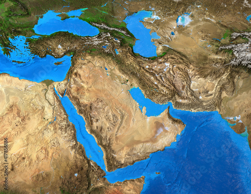
Physical map of Middle East. Geography of Arabian Peninsula. Detailed flat view of the Planet Earth and its landforms. 3D illustration - Elements of this image furnished by NASA

Contributor: mozZz
ID : 417856886

TitleFilesize
Illustration8000x6200


Buy on Adobe Stock

Keywords
middle east, saudi, map, satellite, physical, earth, planet, geography, cartography, continent, detailed, persian, gulf, atlas, topography, flatten, textured, hi-res, geology, country, surface, land, arab, arabian, altitude, earth, world map, landscape, elevation, science, three-dimensional, illustration, large, background, flat, planisphere, landform, relief, mountain, from above, terrain, iran, egypt, sudan, irak, syria, yemen, turkey, red sea, peninsula